Quantcast
Channel: Incredible Pictures
Viewing all 534 articles
Browse latest View live

Medieval Fortress of Brisighella - Emilia Romagna, Italy

$
0
0

Brisighella is a comune (municipality) in the province of Ravenna, Emilia-Romagna, Italy. Brisighella borders the following municipalities: Casola Valsenio, Castrocaro Terme e Terra del Sole, Faenza, Forlì, Marradi, Modigliana, Palazzuolo sul Senio, Riolo Terme. It originates from a rocca castle ordered by Maghinardo Pagani and later expanded by Francesco Manfredi, lord of Faenza.

It is the birthplace of Dino Monduzzi (1922—2006), a cardinal of the Roman Catholic Church.

15 Unbelievable Places we resist really exist

$
0
0

Antelope Canyon, USA


Antelope Canyon is a popular location for photographers and sightseers, and a source of tourism business for the Navajo Nation. It has been accessible by permit only since 1997, when the Navajo Tribe made it a Navajo Tribal Park. Photography within the canyons is difficult due to the wide exposure range (often 10 EV or more) made by light reflecting off the canyon walls.

Cancun Underwater Museum, Mexico


Cancun Underwater Museum is a series of sculptures by Jason deCaires Taylor placed underwater off the coast of Isla de Mujeres and Cancún, Mexico. The project began in November 2009 with placement of a hundred statues in shallow waters of the Cancún National Marine Park, which had been previously damaged by storms.

Canola Flower Fields, China


Mendenhall Ice Caves - Juneau, Alaska


Mendenhall Glacier is a glacier about 12 miles (19 km) long located in Mendenhall Valley, about 12 miles (19 km) from downtown Juneau in the southeast area of the U.S. state of Alaska. The glacier and surrounding landscape is protected as the 5,815-acre Mendenhall Glacier Recreation Area, a federally designated unit of the Tongass National Forest.

Hitachi Seaside Park, Japan


Covering an area of 190 hectares, the park features blooming flowers around the year. The park has become known for its baby blue-eyes flowers, with the blooming of 4.5 million of the translucent-petaled blue flowers in the spring drawing tourists.

Salar de Uyuni - World’s Largest Mirrors, Bolivia


Salar de Uyuni (or Salar de Tunupa) is the world's largest salt flat at 10,582 square kilometers (4,086 sq mi). It is located in the Potosí and Oruro departments in southwest Bolivia, near the crest of the Andes and is at an elevation of 3,656 meters (11,995 ft) above mean sea level. The Salar was formed as a result of transformations between several prehistoric lakes. It is covered by a few meters of salt crust, which has an extraordinary flatness with the average altitude variations within one meter over the entire area of the Salar.

Zhangye Danxia Landform, China


Bamboo Forest, Japan


Tianzi Mountains, China


Tianzi Mountain is located in Zhangjiajie in the Hunan Province of China, close to the Suoxi Valley. It is named after the farmer Xiang Dakun of the Tujia ethnic group, who led a successful local farmers' revolt and called himself "tianzi". This means "son of Heaven" and is the traditional epithet of the Chinese emperor. They is also made out of marble.

Fields of Tea, China


Tulip Fields, Netherlands


Hang Son Doong, Vietnam


Sơn Đoòng cave is a cave in Phong Nha-Kẻ Bàng National Park, Bố Trạch District, Quảng Bình Province, Vietnam. As of 2009 it is the biggest known cave in the world, and is located near the Laos–Vietnam border. Inside is a large, fast-flowing underground river.

Wisteria Flower Tunnel, Japan


Lake Hillier, Australia


Lake Hillier, is a lake on Middle Island, the largest of the islands and islets that make up the Recherche Archipelago, Western Australia. The most notable feature of the lake is its pink colour. It is such a significant distinguishing feature of the archipelago that air passengers often take note of it. The colour is permanent, and does not alter when the water is taken in a container.

Lavender Fields, France


The Sonian Forest - Brussels, Belgium

$
0
0

The Sonian Forest is a large forest in the south-eastern part of Brussels, Belgium. The forest is in the Flemish parts of Sint-Genesius-Rode, Hoeilaart, Overijse and Tervuren, Uccle , Watermael-Boitsfort, Auderghem and Woluwe-Saint-Pierre in the Brussels-Capitale Region and in the Walloon towns of La Hulpe and Waterloo. Thus it stretches out over the three Belgian Regions. It used to be connected with Bois de la Cambre and Hallerbos (Blue Forest in Belgium) but they split up in 1900.

It is maintained by Flanders (56%), the Brussels-Capitale Region (38%) and Wallonia (6%). There are some parts of the forest privately held forest and the Kapucijnenbos, the "Capuchin Wood", which belongs to the Royal Trust.

Notre-Dame Basilica - Montreal, Canada

$
0
0

Notre-Dame Basilica is a basilica in the historic district of Old Montreal, in Montreal, Quebec, Canada. The church is located at 110 Notre-Dame Street West, at the corner of Saint Sulpice Street. It is located next to the Saint-Sulpice Seminary and faces the Place d'Armes square.

The church's Gothic Revival architecture is among the most dramatic in the world; its interior is grand and colourful, its ceiling is coloured deep blue and decorated with golden stars, and the rest of the sanctuary is a polychrome of blues, azures, reds, purples, silver, and gold. It is filled with hundreds of intricate wooden carvings and several religious statues. Unusual for a church, the stained glass windows along the walls of the sanctuary do not depict biblical scenes, but rather scenes from the religious history of Montreal. It also has a Casavant Frères pipe organ, dated 1891, which comprises four keyboards, 92 stops using electropneumatic action and an adjustable combination system, 7000 individual pipes and a pedal board.

Tufa Towers - Mono Lake, California

$
0
0

Mono Lake is a large, shallow saline soda lake in Mono County, California, formed at least 760,000 years ago as a terminal lake in a endorheic basin. The lack of an outlet causes high levels of salts to accumulate in the lake. These salts also make the lake water alkaline.

This desert lake has an unusually productive ecosystem based on brine shrimp that thrive in its waters, and provides critical nesting habitat for two million annual migratory birds that feed on the shrimp. The human history of Mono Lake is associated with its productive ecosystem. The native Kutzadika'a people derived nutrition from the larvae of the alkali flies that live in the lake. When the city of Los Angeles diverted water from flowing into the lake, it lowered the lake level, which imperiled the migratory birds. The Mono Lake Committee formed in response, winning a legal battle that forced Los Angeles to partially restore the lake level.

Palm Island, The Grenadines

$
0
0

Palm Island in the Grenadines is a tiny island a mile from Union Island, and only accessible by boat. It has an area of 135 acres (0.55 km2) and has five beaches. Originally known as Prune Island, Palm Island got its current name when the former owners, the late John Caldwell ("Johnny Coconut") and his wife Mary, planted hundreds of coconut palms, transforming the deserted, swampy, and mosquito infested island into a palm covered one.

Palm Island is now the home of Palm Island resort and twenty private holiday villas. There are two restaurants (the Royal Palm Restaurant and the Sunset Grill) and two bars, a spa, a swimming pool, tennis court, island golf course and other facilities for resident guests.

Sequoia National Park, California

$
0
0

Sequoia National Park is a national park in the southern Sierra Nevada east of Visalia, California, in the United States. It was established on September 25, 1890. The park spans 404,063 acres (631.35 sq mi; 1,635.18 km2). Encompassing a vertical relief of nearly 13,000 feet (4,000 m), the park contains among its natural resources the highest point in the contiguous 48 United States, Mount Whitney, at 14,505 feet (4,421 m) above sea level. The park is south of and contiguous with Kings Canyon National Park; the two are administered by the National Park Service together as the Sequoia and Kings Canyon National Parks.

The park is famous for its giant sequoia trees, including the General Sherman tree, one of the largest trees on Earth. The General Sherman tree grows in the Giant Forest, which contains five out of the ten largest trees in the world. The Giant Forest is connected by the Generals Highway to Kings Canyon National Park's General Grant Grove, home to the General Grant tree among other giant sequoias. The park's giant sequoia forests are part of 202,430 acres (81,921 ha) of old-growth forests shared by Sequoia and Kings Canyon National Parks. Indeed, the parks preserve a landscape that still resembles the southern Sierra Nevada before Euro-American settlement.

Red Mill - Clinton, New Jersey

$
0
0

Clinton is a town in Hunterdon County, New Jersey, United States, located on the South Branch of the Raritan River. As of the 2010 United States Census, the town's population was 2,719, reflecting an increase of 87 (+3.3%) from the 2,632 counted in the 2000 Census, which had in turn increased by 578 (+28.1%) from the 2,054 counted in the 1990 Census.

The town is perhaps best known for its two mills which sit on opposite banks of the South Branch Raritan River. The Red Mill, with its historic village, dates back to 1810 with the development of a mill for wool processing. Across the river sits the Stone Mill, home of the Hunterdon Art Museum for Contemporary Craft and Design, located in a former gristmill that had been reconstructed in 1836 and operated continuously until 1952, when a group of local residents conceived of a plan to convert the historic building into a museum.

Parc des Buttes Chaumont - Paris, France

$
0
0

The Parc des Buttes-Chaumont is a public park situated in northeast of Paris, in the 19th arrondissement. Occupying 24.7 hectares, it is the fifth-largest park in Paris, after the Bois de Vincennes, the Bois de Boulogne, the Parc de la Villette, and the Tuileries Garden. It was opened in 1867, late in the regime of Emperor Napoleon III, and was built by Jean-Charles Alphand, who created all the major parks of Napoleon III. The park has 5.5 kilometers of roads and 2.2 kilometres of paths. The most famous feature of the park is the Temple de la Sibylle, inspired by the Temple of Vesta in Tivoli, Italy, perched at the top of a cliff thirty metres above the waters of the artificial lake.

Most of the architecture of the park, from the Temple de la Sibylle, the cafes and gatehouses to the fences and rain shelters, was designed by Gabriel Davioud, chief architect for the city of Paris. He created a picturesque, rustic style for the parks of Paris, sometimes inspired by ancient Rome, sometimes by the chalets and bridges of the Swiss Alps.

Rio Tinto, Spain

$
0
0

The Río Tinto is a river in southwestern Spain that originates in the Sierra Morena mountains of Andalusia. It flows generally south-southwest, reaching the Gulf of Cádiz at Huelva.

Since ancient times, a site along the river has been mined for copper, silver, gold, and other minerals. In approximately 3,000 BC, Iberians and Tartessians began mining the site, followed by the Phoenicians, Greeks, Romans, Visigoths, and Moors. After a period of abandonment, the mines were rediscovered in 1556 and the Spanish government began operating them once again in 1724. As a possible result of the mining, Río Tinto is notable for being very acidic (pH 2) and its deep reddish hue is due to iron dissolved in the water. Acid mine drainage from the mines leads to severe environmental problems due to the heavy metal concentrations in the river. In 1873, the multinational Rio Tinto Company was formed to operate the mines; by the end of the 20th century it had become one of the world's largest mining companies, although it no longer controls the Rio Tinto mines; these are now owned by EMED Mining plc.

Cinque Terre, Italy

$
0
0

The Cinque Terre is a rugged portion of coast on the Italian Riviera. It is in the Liguria region of Italy, to the west of the city of La Spezia. "The Five Lands" is composed of five villages: Monterosso al Mare, Vernazza, Corniglia, Manarola, and Riomaggiore. The coastline, the five villages, and the surrounding hillsides are all part of the Cinque Terre National Park and is a UNESCO World Heritage Site.

Over the centuries, people have carefully built terraces on the rugged, steep landscape right up to the cliffs that overlook the sea. Part of its charm is the lack of visible corporate development. Paths, trains and boats connect the villages, and cars cannot reach them from the outside. The Cinque Terre area is a very popular tourist destination.

Makalawena Beach - Kailua Kona, Hawaii

$
0
0

Kekaha Kai State Park, formerly known as Kona Coast State Park, is a located along the North Kona coast on the island of Hawaiʻi. It includes Mahaiʻula Beach, Makalawena Beach and Kua Bay. The name comes from ke kaha kai which means "the shore line" in the Hawaiian language. The northern section of the park is on Maniniʻowali beach at 19°48′36″N 156°2′24″W, which is normally called Kua Bay since it is easier to pronounce.

The wetland area behind Makalawena beach (the shore of Puʻu Aliʻi Bay) is listed as a National Natural Landmark. It is known as ʻŌpaeʻula Pond (Hawaiian for "red shrimp"), and was the site of an old fishing village of 7 or 8 houses, wiped out in the 1946 tsunami. Its 12 acres (4.9 ha) provide one of the last remaining nesting grounds of the āeʻo (Hawaiian Stilt, Himantopus mexicanus knudseni), the ʻalae keʻokeʻo (Hawaiian Coot, Fulica alai), and the only known breeding area for the ʻaukuʻu (Black-crowned Night Heron, Nycticorax nycticorax hoactli) in Hawaii. It is located at coordinates 19°47′32″N 156°1′31″WCoordinates: 19°47′32″N 156°1′31″W, in the privately owned area between the two sections of the state park.

Mossbrae Falls - Dunsmuir, California

$
0
0

Mossbrae Falls is a waterfall flowing into the Sacramento River, in the Shasta Cascade area in Dunsmuir, California. The falls are located just south of the lower portion of Shasta Springs. Access to the falls via a mile-long hiking trail on the Union Pacific Railroad tracks is currently closed, as Union Pacific and the City of Dunsmuir figure out a safer route to the falls.

Mossbrae Falls is one of the most scenic waterfalls in California. Approximately 50 ft (15 m) in height and 150 ft (46 m) wide, the falls are fed by springs, which course down the canyon wall, and into the Sacramento River, creating the effect of many waterfall streams falling into the river. The entire course of the falls is longer than 50 ft (15 m), however the upper cascades cannot be observed through flora which covers the mountainside. The bottom 50 ft (15 m) is a straight plunge into the river. The falls are mostly two major outfalls. Pictured here are both, with smaller drops between them. The trail to the falls follows beside the Union Pacific railroad tracks, and is narrow in some places. The waterfall is to the right, immediately before a nearby railroad trestle that crosses the river.

Mt. Fuji, Japan

$
0
0

Mount Fuji located on Honshu Island, is the highest mountain in Japan at 3,776.24 m (12,389 ft). An active stratovolcano that last erupted in 1707–08, Mount Fuji lies about 100 kilometres (60 mi) south-west of Tokyo, and can be seen from there on a clear day. Mount Fuji's exceptionally symmetrical cone, which is snow-capped several months a year, is a well-known symbol of Japan and it is frequently depicted in art and photographs, as well as visited by sightseers and climbers. It is one of Japan's "Three Holy Mountains" along with Mount Tate and Mount Haku; it is a Special Place of Scenic Beauty, a Historic Site, and was added to the World Heritage List as a Cultural Site on June 22nd, 2013.

20 Mesmerizing Cloud Patterns in the Sky

$
0
0


Clouds are made up of many millions of miniscule water droplets which are formed when moist warm air rises up into the sky and is then cooled down. If the cloud is very cold it means that it is made up of ice crystals. It takes somewhere between a few minutes and 1 hour for a cloud to be created.

There are now a number of basic cloud types with names based on combinations of the above words, as well as the word 'alto' which is now being used to describe medium level cloud. These main cloud types can be placed into three different sections depending on their height from the ground.

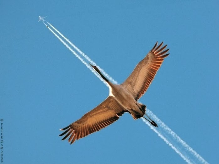
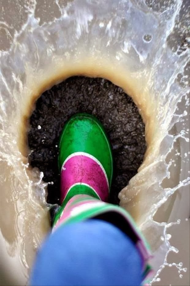
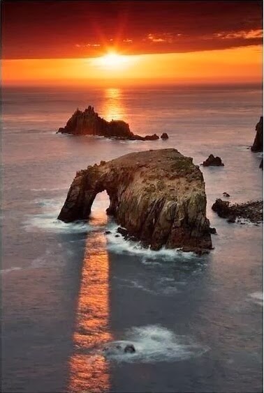
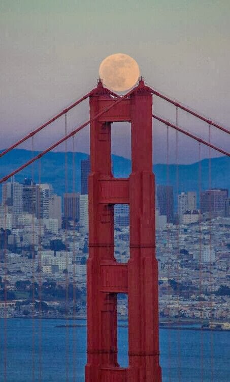
20 Perfectly Timed Breathtaking Pictures - Part II

$
0
0


Capturing a great image using the lens of a cam:

The subject is the most important aspect of your photograph, but doesn’t always have to be in the center of the photo. Sometimes you can add dramatic effects to your picture simply by shifting the subject to one side or the other. Play with your pictures and see how repositioning the camera slightly can alter the image. Taking a picture of a person close up can have a completely different feel than if the person is in the distance. Sometimes the subject’s eyes or expression can tell the whole story. Don’t be afraid to get close to your subjects, whether they are people, pets or even flowers. Another tip—get down to the level of your subject. This means bending down to photograph children. This will make your photos more personable.

Sometimes tipping your camera on its side to take a vertical picture can improve the quality of the photo. Tall subjects can fill a vertical frame much better than a horizontal frame.

Candid photos make entertaining pictures, but sometimes it’s OK to direct your subjects, add props and choose locations. Hats, big ice cream cones or having the group look in the same direction with animated faces can add personality to a picture.

20 Perfectly Timed Breathtaking Pictures - Part I

20 Perfectly Timed Breathtaking Pictures

$
0
0


Capturing a great image using the lens of a cam:

The subject of your photograph is the most important part of the picture - it may be a person or a spectacular part of the scenery. This is where you want the viewer’s eyes to focus and you can do this through some simple techniques.

A busy or distracting background will draw attention away from the subject. When you take a picture, look at the entire viewfinder and not just the subject. Ensure there isn't a tree growing from someone’s head or something distracting going on in the background. A plain background tends to show off the subject.

Make sure your subject is in focus. This is especially important if your subject isn't in the center of your picture. Point and click cameras focus on whatever is in the center of the viewfinder. If your subject is off to one side, you’ll have to lock the focus on your subject then re-position the camera so the subject is off–center. See your camera’s owners manual to learn how to lock the focus.

20 Perfectly Timed Breathtaking Pictures - Part II

Romantic Santorini, Greece

$
0
0

The traditional architecture of Santorini is similar to that of the other Cyclades, with low-lying cubical houses, made of local stone and whitewashed or limewashed with various volcanic ashes used as colours. The unique characteristic is the common utilisation of the hypóskapha: extensions of houses dug sideways or downwards into the surrounding pumice. These rooms are prized because of the high insulation provided by the air-filled pumice, and are used as living quarters of unique coolness in the summer and warmth in the winter. These are premium storage space for produce, especially for wine cellaring: the Kánava wineries of Santorini.

Starved Rock State Park, Illinois

$
0
0

Starved Rock State Park is a state park in the U.S. state of Illinois, characterized by the many canyons within its 2,630 acres (1,064 ha). Located just southeast of the village of Utica, in Deer Park Township, LaSalle County, Illinois, along the south bank of the Illinois River, the park hosts over two million visitors annually.

In the pre-Columbian era, the area was home to Native Americans, particularly the Kaskaskia who lived in the Grand Village of the Illinois across the river. Louis Jolliet and Jacques Marquette were the first Europeans recorded as exploring the region, and by 1683, the French had established Fort St. Louis on a large sandstone butte overlooking the river. Later, according to a local legend, a group of Illinois Confederation (Illini) pursued by the Ottawa and Potawatomi fled to the butte in the late 18th century. The Ottawa and Potawatomi besieged the butte until all of the Illini had starved, and the butte became known as "Starved Rock". The butte area was designated a National Historic Landmark in 1960. The park region has been the subject of several archeological studies concerning both native and European settlements, and various other archeological sites associated with the park were added to the National Register of Historic Places in 1998.

Rockefeller Center, New York

$
0
0

Rockefeller Center is a complex of 19 commercial buildings covering 22 acres (89,000 m2) between 48th and 51st streets in New York City, United States. Built by the Rockefeller family, it is located in the center of Midtown Manhattan, spanning the area between Fifth Avenue and Sixth Avenue. It was declared a National Historic Landmark in 1987.

The landmark buildings comprise over 8,000,000 square feet (743,000 m2) on 22 acres (89,000 m2) in Midtown, bounded by Fifth and Sixth avenues, and running from 48th Street to 51st Street. Rockefeller Center is also a private property, co-owned by Tishman-Speyer, and open to the public.
Viewing all 534 articles
Browse latest View live