Quantcast
Channel: Incredible Pictures
Viewing all 534 articles
Browse latest View live

Riviera Maya, Mexico

$
0
0

Riviera Maya, also known as the Mayan Riviera, is a tourism district following the coastal Highway 307 which parallels the Caribbean coastline of the Mexican state of Quintana Roo, located on the eastern portion of the Yucatán Peninsula. This district historically started at the city of Playa del Carmen and ended at the village of Tulum, although the towns of Puerto Morelos situated to the north and between Playa del Carmen and Cancun as well as the town of Felipe Carrillo Puerto situated 40 kilometres (25 mi) to the south of Tulum are both currently being promoted as part of the Riviera Maya tourist corridor.

The Riviera Maya was originally called the Cancun - Tulum corridor, but in 1999 it was renamed as the Riviera Maya with the aid of Lic. Miguel Ramón Martín Azueta who at the time was the mayor of the municipality of Solidaridad, Quintana Roo. The municipality of Solidaridad includes the whole of the official Riviera Maya from Playa del Carmen in the north and south to Tulum and extending to some 40 km inland with the border with the state of Yucatan.
Redwood National Park, California

$
0
0

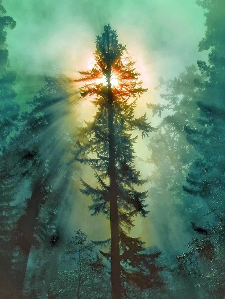
The Redwood National and State Parks (RNSP) are located in the United States, along the coast of northern California. Comprising Redwood National Park (established 1968) and California's Del Norte Coast, Jedediah Smith, and Prairie Creek Redwoods State Parks (dating from the 1920s), the combined RNSP contain 133,000 acres (540 km2). Located entirely within Del Norte and Humboldt Counties, the four parks, together, protect 45% of all remaining coast redwood (Sequoia sempervirens) old-growth forests, totaling at least 38,982 acres (157.75 km2). These trees are the tallest and one of the most massive tree species on Earth. In addition to the redwood forests, the parks preserve other indigenous flora, fauna, grassland prairie, cultural resources, portions of rivers and other streams, and 37 miles (60 km) of pristine coastline.

Gold Coast - Australia

$
0
0

The Gold Coast is a coastal city in southeastern Queensland on the east coast of Australia. The city is 94 km (58 mi) south of the state capital Brisbane. It is the second most populous city in the state, the sixth most populous city in the country, and the most populous non-capital city in Australia. The Gold Coast has the largest cross-state metropolitan area population in Australia, due to the inclusion of Tweed Heads, New South Wales in its metropolitan area. The Gold Coast's metropolitan area converges with that of Greater Brisbane, forming part of an urban conurbation of over 3 million people.

While the origin of the city's name is debatable, the name "Gold Coast" was bestowed upon the city by real estate investors. The first settlement in what is now South East Queensland was as a penal colony at Redcliffe. The Gold Coast region remained largely uninhabited by Europeans until 1823 when explorer John Oxley landed at Mermaid Beach. The hinterland's red cedar supply attracted people to the area in the mid-19th century. Later in 1875, Southport was surveyed and established and grew a reputation as a secluded holiday destination for upper class Brisbane residents.

Maia, Seychelles

$
0
0

Tourism in Seychelles:

In 1971, with the opening of Seychelles International Airport, tourism became a significant industry, essentially dividing the economy into plantations and tourism. The tourism sector paid better, and the plantation economy could only expand so far. The plantation sector of the economy declined in prominence, and tourism became the primary industry of Seychelles.

In recent years the government has encouraged foreign investment to upgrade hotels and other services. These incentives have given rise to an enormous amount of investment in real estate projects and new resort properties, such as project TIME, distributed by the World Bank, along with its predecessor project MAGIC. Despite its growth, the vulnerability of the tourist sector was illustrated by the sharp drop in 1991–1992 due largely to the Gulf War. Since then the government has moved to reduce the dependence on tourism by promoting the development of farming, fishing, small-scale manufacturing and most recently the offshore financial sector, through the establishment of the Seychelles International Business Authority (SIBA) and the enactment of several pieces of legislation (such as the International Corporate Service Providers Act, the International Business Companies Act, the Securities Act, the Mutual Funds and Hedge Fund Act, amongst others).

20 Amazing Reflections on Water

$
0
0


Capturing a great image using the lens of a cam:

Light is one of the most important aspect of a photograph. Whether the photographer utilizes natural light or a flash—the type, amount and location of the light source should always be considered. Different lighting can change the entire appearance of a photograph.

The bright sun can create deep shadows on the face and intensify wrinkles, scars and blemishes. When taking pictures on sunny days, it’s a good idea to use your flash to lighten your subject’s face and reduce unattractive shadows.

Overcast days often provide pleasing results without the use of a flash or other artificial light sources. If you do use a flash, try the camera’s fill–flash mode if it has one. The flash will lighten the subject’s appearance and make it stand out.

When using a flash, make sure the subject is within the flash’s range. Most cameras have a range of up to 15 feet. Check your owner’s manual for the specifics on your camera’s flash range. To be safe, don’t position your subjects further than 10 feet away.

San Diego Bay, California

$
0
0

San Diego Bay is a natural harbor and deepwater port located in San Diego County, California near the US-Mexico border. The bay, which is 12 miles (19 km) long and 1 to 3 miles (1.6 to 4.8 km) wide, is the third largest of the three large, protected natural bays on California's entire 840 miles (1,350 km) long coastline after San Francisco Bay and Humboldt Bay. The highly urbanized land adjacent to the bay includes the city of San Diego (eighth largest city in the United States) and four other cities, including National City, Chula Vista, Imperial Beach and Coronado.

Considered to be one of the best natural harbors on the west coast of North America, it was colonized by Spain beginning in 1769. Later it served as base headquarters of major ships of the United States Navy in the Pacific until just before the United States entered World War II, when the newly organized United States Pacific Fleet primary base was transferred to Pearl Harbor, Hawaii. However, San Diego Bay remains as a home port of major assets, including several aircraft carriers, of the United States Pacific Fleet, and as a result of base closures beginning in the 1980s, facilities in San Diego Bay are the only remaining major naval base facilities still in operation in the entire State of California.

Interior of Chapel - Versailles, Paris

$
0
0

The Palace of Versailles or simply Versailles, is a royal château in Versailles in the Île-de-France region of France. In French it is the Château de Versailles.

When the château was built, Versailles was a country village; today, however, it is a wealthy suburb of Paris, some 20 kilometres southwest of the French capital. The court of Versailles was the center of political power in France from 1682, when Louis XIV moved from Paris, until the royal family was forced to return to the capital in October 1789 after the beginning of the French Revolution. Versailles is therefore famous not only as a building, but as a symbol of the system of absolute monarchy of the Ancien Régime.

Turquoise Sea - Sardinia, Italy

$
0
0

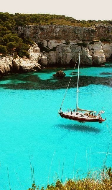
Sardinia is the second largest island in the Mediterranean Sea (after Sicily and before Cyprus) and an autonomous region of Italy. The nearest land masses are (clockwise from north) the island of Corsica, the Italian Peninsula, Sicily, Tunisia, the Balearic Islands and Provence. The region has its capital in its largest city, Cagliari, and is divided into eight provinces. All local languages (Sardinian, Sassarese, Gallurese, Catalan Algherese and Tabarchino) enjoy "equal dignity" with Italian each in the concerned territory by a regional law.

Sardinia is the second largest island in the Mediterranean Sea, with an area of 23,821 square kilometres (9,197 sq mi). It is situated between 38° 51' and 41° 15' latitude north and 8° 8' and 9° 50' east longitude. To the west of Sardinia is the Sea of Sardinia, a unit of the Mediterranean Sea; to Sardinia's east is the Tyrrhenian Sea, which is also an element of the Mediterranean Sea.

Snowy Disneyland in Paris, France

$
0
0

Disneyland Paris, originally Euro Disney Resort, is an entertainment resort in Marne-la-Vallée, a new town located 32 km (20 mi) east of the centre of Paris and is the most visited attraction in all of France and Europe. It is owned and operated by Euro Disney S.C.A., a publicly traded company in which The Walt Disney Company owns a minority stake. The resort covers 4,800 acres (19 km2) and encompasses two theme parks, several resort hotels, a shopping, dining, and entertainment complex, and a golf course, in addition to several additional recreational and entertainment venues. Disneyland Park is the original theme park of the complex, opening with the resort on 12 April 1992. A second theme park, Walt Disney Studios Park opened in 2002.

The resort is the second Disney park to open outside the United States, following Tokyo Disney Resort, and the first to be owned and operated by Disney (through Euro Disney S.C.A.). The resort was designed specifically to follow the model established by Walt Disney World in Florida. Park attendance, hotel occupancy and revenues initially fell below projections, but in July 1995 the company saw its first quarterly profit. However, the resort still struggles to be profitable even to this day because of its large debt.

Seine River - Paris, France

$
0
0

The Seine is a 776 km long river and an important commercial waterway within the Paris Basin in the north of France. It rises at Source-Seine, 30 kilometers northwest of Dijon in northeastern France in the Langres plateau, flowing through Paris and into the English Channel at Le Havre (and Honfleur on the left bank). It is navigable by ocean-going vessels as far as Rouen, 120 km (75 mi) from the sea. Over 60% of its length, as far as Burgundy, is negotiable by commercial riverboats and nearly its whole length is available for recreational boating; excursion boats offer sightseeing tours of the Rive Droite and Rive Gauche within the city of Paris.

There are 37 bridges within Paris and dozens more spanning the river outside the city. Examples in Paris include the Pont Louis-Philippe and Pont Neuf, the latter of which dates back to 1607. Outside the city, examples include the Pont de Normandie, one of the longest cable-stayed bridges in the world, which links Le Havre to Honfleur.

Urup Island, Russia

$
0
0

Urup is an uninhabited volcanic island in the Kuril Islands chain in the south of the Sea of Okhotsk, northwest Pacific Ocean. Its name is derived from the Ainu language word for salmon trout.

Urup was originally inhabited by the Ainu, the native peoples of the Kurils, Sakhalin and Hokkaidō. The first recorded visit by Europeans was in 1643, when a ship of the Dutch East India Company commanded by Maarten Gerritsz Vries landed, probably seeking furs. It appears on an official map showing the territories of Matsumae Domain, a feudal domain of Edo period Japan dated 1644, and these holdings were officially confirmed by the Tokugawa shogunate in 1715. Administration of the island came under the Matsumae domain’s regional office location on Kunashir from 1756.

Varenna, Italy

$
0
0

Varenna is a comune (municipality) on Lake Como in the Province of Lecco in the Italian region Lombardy, located about 60 km north of Milan and about 20 km northwest of Lecco. Varenna borders the following municipalities: Esino Lario, Lierna, Oliveto Lario, Perledo; and, across the lake in the province of Como: Bellagio, Griante, Menaggio. The main sights is the Castello di Vezio, which, among the rest, houses a small museum dedicated to the Lariosaurus, a sea reptile from the Middle Triassic period.

Varenna was founded by local fishermen in 769, and was later allied of the commune of Milan. In 1126 it was destroyed by the rival commune of Como, and later received the refugees from the Isola Comacina, who had met the same fate (1169).
Reykjavík, Iceland

$
0
0

Reykjavík is the capital and largest city of Iceland. Its latitude, at 64°08' N, makes it the world's northernmost capital of a sovereign state. It is located in southwestern Iceland, on the southern shore of the Faxaflói Bay. With a population of around 120,000 (and over 200,000 in the Greater Reykjavík Area), it is the heart of Iceland's cultural, economic and governmental activity.

Reykjavík is believed to be the location of the first permanent settlement in Iceland, which Ingólfur Arnarson is said to have established around AD 870. Until the 18th century, there was no urban development in the city location. The city was founded in 1786 as an official trading town and grew steadily over the next decades, as it transformed into a regional and later national centre of commerce, population, and governmental activities. It is among the cleanest, greenest, and safest cities in the world.

15 Strange and Unusual Homes you have never seen

$
0
0


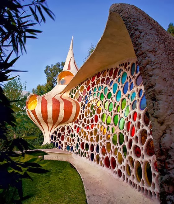
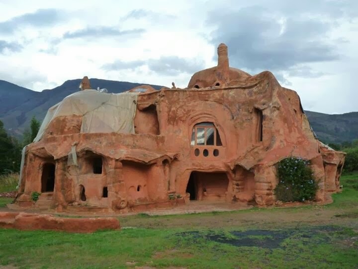
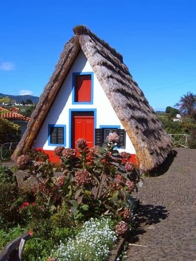
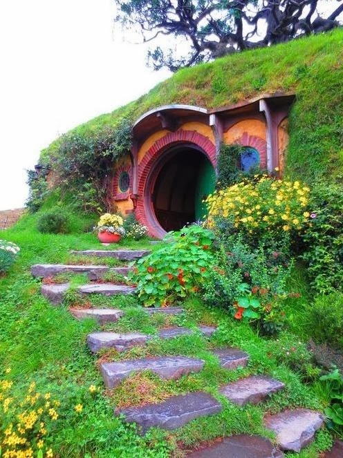
A home is generally a place that is close to the heart of the owner, and can become a prized possession. It has been argued that psychologically "The strongest sense of home commonly coincides geographically with a dwelling. Usually the sense of home attenuates as one moves away from that point, but it does not do so in a fixed or regular  Since it can be said that humans are generally creatures of habit, the state of a person's home has been known to physiologically influence their behavior, emotions, and overall mental health. People may become homesick when they leave their home over an extended period of time.

Everyone has a different notion of what an ideal home should be, here we looked at innovative, bizarre and one-of-a-kind homes and what makes them stand out.

Ancient Bristlecone Pine Forest, California

$
0
0

The Ancient Bristlecone Pine Forest is high in the White Mountains in Inyo County in eastern California. The Great Basin Bristlecone Pine (Pinus longaeva) trees grow between 9,800 and 11,000 feet (3000–3400 m) above sea level, in xeric alpine conditions, protected within the Inyo National Forest. Foxtail Pine (Pinus balfouriana) also grow in the forest.

The forest is east of the Owens Valley, high on the eastern face of the White Mountains in the upper Fish Lake-Soda Spring Watershed, above the northernmost reach of the Mojave Desert into Great Basin ecotone. The forest's mountain habitat is in the Central Basin and Range ecoregion (EPA) and Taiga and Boreal forest ecoregion (WWF). The Patriarch Grove is the source of Cottonwood Creek, a designated Wild and Scenic River.

Antipaxos, Greece

$
0
0

Antipaxos is a small island (5 km²) in Greece, about 3 kilometres (2 miles) to the south of Paxos. It reported a population of 64 inhabitants at the 2001 census, and is administratively part of the municipality of Paxoi in Corfu regional unit in western Greece. Largely covered in vineyards, Antipaxos has several beaches and one harbour, Agrapidia.

It has three main beaches: Vrika (white sand), Mesovrika (pebbles) and Voutoumi (pebbles) and it can be reached by 15-minute ride with a sea-taxi from the port of Gaios in Paxos.

Machu Picchu, Peru

$
0
0

Machu Picchu or Machu Pikchu is a 15th-century Inca site located 2,430 metres (7,970 ft) above sea level. It is located in the Cusco Region, Urubamba Province, Machupicchu District in Peru. It is situated on a mountain ridge above the Sacred Valley which is 80 kilometres (50 mi) northwest of Cusco and through which the Urubamba River flows. Most archaeologists believe that Machu Picchu was built as an estate for the Inca emperor Pachacuti (1438–1472). Often mistakenly referred to as the "Lost City of the Incas", it is perhaps the most familiar icon of Inca civilization.

The Incas built the estate around 1450, but abandoned it a century later at the time of the Spanish Conquest. Although known locally, it was unknown to the outside world before being brought to international attention in 1911 by the American historian Hiram Bingham. Since then, Machu Picchu has become an important tourist attraction. Most of the outlying buildings have been reconstructed in order to give tourists a better idea of what the structures originally looked like. By 1976, thirty percent of Machu Picchu had been restored. The restoration work continues to this day.

20 Amazing Pictures of Nature's Creativity - Trees

$
0
0


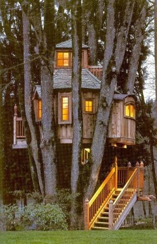
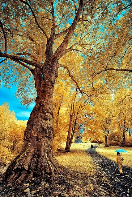
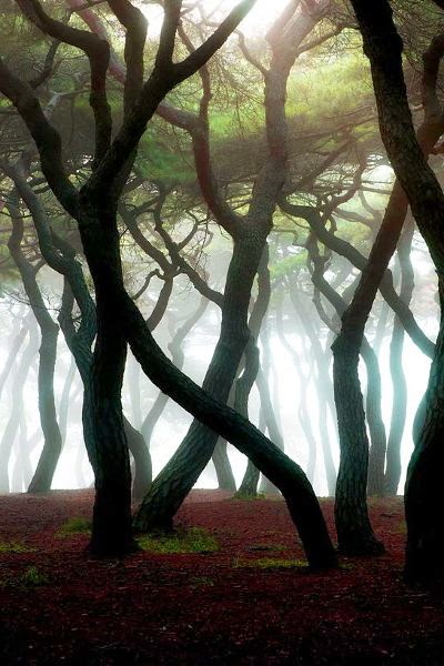
Character is like a tree and reputation like a shadow. The shadow is what we think of it; the tree is the real thing.
- Abraham Lincoln

All religions, arts and sciences are branches of the same tree.
- Albert Einstein

Someone is sitting in the shade today because someone planted a tree a long time ago.
- Warren Buffett

A people without the knowledge of their past history, origin and culture is like a tree without roots.
- Marcus Garvey

The tree of liberty must be refreshed from time to time with the blood of patriots and tyrants.
- Thomas Jefferson

Budapest, Hungary

$
0
0

Budapest is the capital and the largest city of Hungary, and one of the largest cities in the European Union. It is the country's principal political, cultural, commercial, industrial, and transportation centre, sometimes described as the primate city of Hungary. In 2011, according to the census, Budapest had 1.74 million inhabitants, down from its 1989 peak of 2.1 million due to suburbanization. The Budapest Commuter Area is home to 3.3 million people. The city covers an area of 525 square kilometres (202.7 sq mi) within the city limits. Budapest became a single city occupying both banks of the river Danube with a unification on 17 November 1873 of west-bank Buda and Óbuda with east-bank Pest.

Neist Point - Isle of Skye, Scotland

$
0
0

Neist Point is a popular viewpoint on the most westerly point of Skye. Neist Point Lighthouse has been located there since 1909. Neist Point is the most westerly point on the Duirinish peninsula on the Isle of Skye. It projects into The Minch and provides a popular walk and viewpoint. Basalt at Neist Point is very similar to that at the Giant's Causeway in Northern Ireland. A steep path leads down from the road. It is a good place to see whales, dolphins, porpoises and basking shark. Common sea-birds include Gannets, Black Guillemots, Razorbills and European Shags. Several rare plants, including saxifrages are found on the point.
Viewing all 534 articles
Browse latest View live